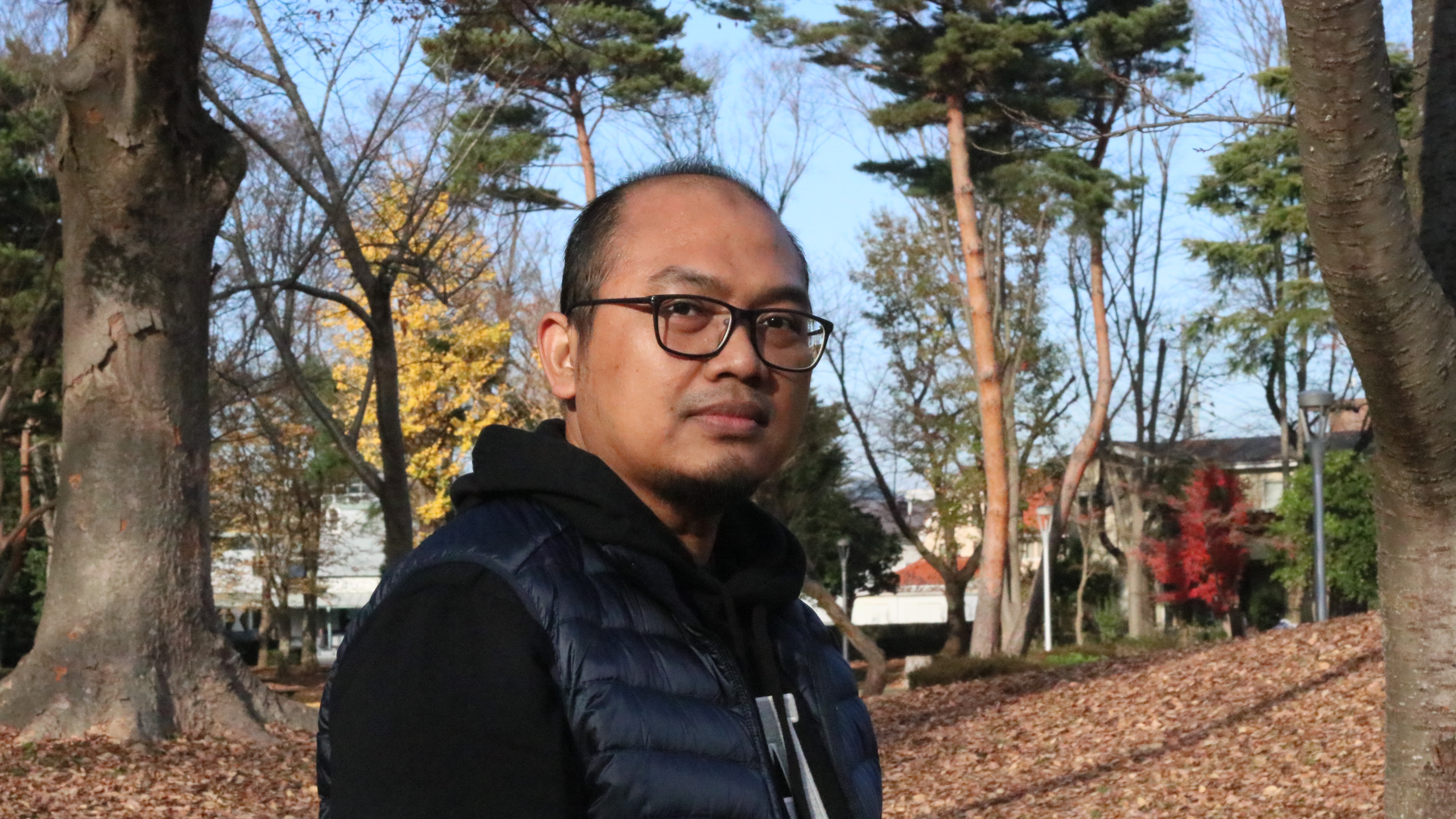
IMG_0697

Dr. Fatwa Ramdani is currently an Assistant Professor at the University of Tsukuba, Japan. Before joint the University of Tsukuba, he was a lecturer in the Information System Department at Brawijaya University. Previously, he served as the Director of the Geoinformatics Research Group at Brawijaya University and was a member of the IEEE Indonesia Section. His affiliations now include the IEEE Geoscience and Remote Sensing Society, the Japan Society of Photogrammetry and Remote Sensing, the Remote Sensing Society of Japan, and the European Geoscience Union (EGU).

Dr. Ramdani holds a PhD and M.Sc. in Earth Science from Tohoku University and a BA in Earth Science from the University of Indonesia. His research focuses on geographical information analysis and remote sensing, resulting in the publication of 4 books and over 30 refereed conference and journal articles. Notably, he received the 2015 Excellence Geospatial Award (Geospatial Media and Communication) and the 2017 & 2018 World Class University Program (Brawijaya University). In 2019, he was granted funding and an award from PlanetScope and the European Space Agency. Moreover, he actively serves as a reviewer for various journals including Nature Communications, International Journal of Remote Sensing, Climatic Change, Remote Sensing of Environment, and Global Environmental Change.


Scientific Publications:

Please refer to the Google Scholar

28 responses to “About me”

  1. shabaz hadi jalal Avatar
    shabaz hadi jalal

    I NAME is shabaz hadi the part surving of kurdstan iraq i need a image pliss send me image surving

  2. Dear Shabaz Hadi,
    I can not understand your inquiry. Did you mean you need satellite image of Kurdistan instead of Kurdstan?
    like in this link (http://en.wikipedia.org/wiki/Kurdistan). Please let me know the details?

  3. Trevor Moffiet Avatar
    Trevor Moffiet

    Dear Fatwa,
    Have you tried application of the first three PPS index transformations (PPSG,PPSB,PPSW) to any of your Landast ETM or ETM+ images and compared them with Tasseled Cap (Brightness,Greennesss and Wetness) transformations applied to the same image/s?
    If not, and if you are interested, then :
    ^ Choose an image/sub-scene that containes water, agricultural crop and forest.

    ^ To apply the transformations use the as published eigenvectors given in table 2 of “Motivation, development and validation of a new spectral greenness index:
    A spectral dimension related to foliage projective cover” (Apply these in the same way that you would apply the Huang Tasseled Cap eigenvectors)

    ^ apply the angular conversions using published the spectral focus

    ^ Use colour stretches indicated in caption of figure 6.

    I would be interested in how the transformations compare. For example, I would be interested in your interpretations of a 3-layer Tasseled Cap transformed image compared to a 3-layer PPS transformed image.

    Contact me by email if you need more information on how to apply PPS transformations. I have not worked in field of Remote Sensing since I completed that paper. I have never applied PPS index transformations to any images outside of Queensland Australia.

    Regards,
    Trevor Moffiet

  4. Dear Moffiet,

    I reply via email, please check your inbox.

    Regards,

    Fatwa

  5. Dear Fatwa,
    I found an article (http://dgl.us.neolane.net/res/img/a472b4fe15a04236de821bfa01932f3c.pdf) where you explore the WorldView images for SEBAL. I figure if u have a full paper about this job.

    Regars,
    Anderson Reis

  6. Dear Reis,

    I do really sorry for late reply, because I was in the field work trip last month. I sent my paper to your email. Thx

    Fatwa

  7. can you teach me how to get temperature information from landsat image band6, couse it appears in pseudo color.tengs

  8. hi,
    What kind of software are you familiar with?
    you can try to use GRASS (open source), then follow steps on this link:

    How to derive surface temperature from thermal band using GRASS?

  9. Hi Mr. Ramdani, I just read an article of yours here about the resources of Indonesia. I was wondering if you had the source for the map you posted which shows the geothermal potential in Indonesia? this one: https://fatwaramdani.files.wordpress.com/2011/03/geothermal-indonesia.jpg

  10. assalamualaikum. saya memerlukan peta yang menunjukkan penambahan luas perkebunan kelapa sawit di kalimantan timur sejak 1970 hingga saat ini. apa mas fatwa punya rujukan lembaga mana yang bisa saya tuju? terima kasih.

  11. waalaykumsalam, sampai saat ini sy tdk menemukan ada lembaga yg menyediakan resmi data2 tsb 😉
    untuk Kaltim sejauh analisa sy, sawit baru ada pada period 1990s

  12. Rochamukti Rizcanofana Avatar
    Rochamukti Rizcanofana

    Assalamualaikum Mr. Fatwa.
    Saya ingin menggunakan algoritma NDVI pada citra Worldview-2. Tetapi komposit warna yang saya punya hanya natural color saja. Apakah bisa ya pak?
    Trims

    Regards

  13. Waalaykumsalam wr wb

    Coba dicek dulu di ENVI (software image processing), apakah data anda memiliki semua band yg dibutuhkan untuk analisa NDVI (Red and NIR).
    Klo ada berarti bisa, klo sudah jadi file image biasa (natural color) sepertinya tidak bisa, tapi coba aja dicek dulu

    Salam

  14. As.Alaikum Pak Fatwa
    Sy mo estimated Abovegound biomass in oil palm plantation in SOuth Sulawesi Indonesia using Lidar data and Ifsar data.
    boleh sy dapat alamat email pak Fatwa?
    ini alamt email sy: putri_idaw@yahoo.com
    mksh pak
    wassalam

  15. Waalaykumsalam wr wb
    Check your mailbox

  16. As.Alaikum Pak Fatwa.

    Saya sangat tertarik dengan artikel yang ditulis oleh bapak tentang surface temperature land..saya sangat newbie tentang remote sensing. apakah sya bisa berdiskusi dengan bapak..?. ini alamt email saya : margareth_85@yahoo.com
    maksih pak.
    wassalam.

  17. Waalaykumsalam
    Silahkan di cek inbox emailnya ya 🙂

  18. Assalamualaikum Pak Fatwa, salam kenal, saya Agha. Saya ingin membaca jurnalnya yang berjudul “Comparing of lineaments extraction from ALOS and Landsat images for supporting exploration of geothermal field in Indonesia”, akan tetapi semuanya berbayar, sehingga saya tidak bisa mengakses secara penuh. Apakah bisa dikirimkan ke email saya apabila anda berkenan? email saya agha.achmad@yahoo.co.id. Terima kasih atas tanggapannya.

  19. Waalaykumsalam wr wb.
    Silahkan di cek inboxnya ya 😉

  20. Pak Fatwa,
    Saya bekerja di BLH Provinsi Kalteng, tadi yampe ke sini selagi mencari-cari cara menggunakan Landsat 8 TIRS untuk persiapan menghadapi kemarau tahun depan. Biasanya orang hanya anggap hotspot sbgai titik api dan hidup mati dengan NOAA/AVHRR data. Saya sudah search tetapi tdk ada yang pakai integrated, MODIS Aqua (sekitar 10 pagi) MODIS Terra (sekitar 14.30?) dan AVHRR (yang malam, jam …), maksud saya mengejar chance ttik panas adalah titik api secara free apalagi bila itu api sengaja oleh perkebunan, dll. susah karena scope per 1 hotspot 1 km2 jadi kalau bisa integrated MODIS-NOAA, dilihat confidence level dan Fire Radiative Powernya kemudian secepatnya dilihat pada LAndsat 8 yang akan lewat, urutan tindakan akan lebih efisien, efektif dan scientific.
    Sekali lagi terima kasih atas tulisannya.

  21. Pak Fatwa

    Can I get your email address so as to communicate in private. I need some assistance in the whole concept of geoinformatics

  22. Drop me email to: fatwaramdani[at]ub[dot]ac[dot]id

  23. Salam Pak Fatwa,

    Saya mau mengetahui lebih jelas tentang teknologi yang Bapak kembangkan. Saya sudah email ke Bapak email saya ke email di atas. Terima kasih.

    Rico.

  24. Hi mas Rico,

    Saya sudah cek inbox, tapi tidak menemukan email dari anda. Untuk lebih jelas mengenai teknologi yg saya kembangkan silahkan datang ke Fakultas Ilmu Komputer UB, Malang. Saya tunggu ya!

    Salam

  25. Annisa Fildza Avatar
    Annisa Fildza

    Greetings, Mr. Fatwa!
    I am one of your audience from your latest seminar in Makassar, currently a 2 semester student. Frankly, I was fascinated by the satellite images you showed us that day explaining the sedimentation of Makassar from year to year.
    Right now I am facing some difficulties taking similar images, and wondering if you could share some of the sites or software you’re using to took them.

    Bunch of thanks beforehand.

  26. Hi Annisa,
    Please check the following URL:

  27. Assalamualikum wr.wb
    Saya Azizi, saya tertarik dengan penelitian anda di malang baru baru ini, saya harap dapat mempelajarinya juga,mohon agar di share publikasinya. berikut email saya azizidermawan@gmail.com

    nuwun,
    wassalamulaikum wr.wb

Leave a comment

Trending

Blog at WordPress.com.